The great challenge facing Italy is about reducing the negative effects produced by climate change, such as rise of desertification, reduction of agricultural yields, increasing pollution and energy requirements, global reduction of natural resources. All this upon a very fragile territory, characterized by high hydrogeological, volcanic and seismic risk. Modern remote sensing for Earth observation technologies can make an important contribution to institutions in the study, analysis and management of these modifications and create new business opportunities for most dynamic companies. The Remote Sensing Laboratory is an R&D, consulting and training facility operating in the field of remote sensing and geo-information. The main fields of application are environment and territory, energy, natural resources, security and space.
Geographic Information Systems (Geodatabases/GIS/WEBGIS)
Geographic Information Systems (Geodatabases/GIS/WEBGIS) and land information systems for the management, online or otherwise, of georeferenced data, Google Earth and the development of service applications. Creation of geodatabases of map, land and satellite data. Creation and management of Open Source Geoportals and the development of applications based on geospatial services with the use of Virtual Hub Discovery and Access in order to access BIG Data, data from satellites and various maps published in the form of OpenData, INSPIRE and COPERNICUS compliant and EU platforms. Production of thematic and metric maps from satellite or aerial images. Numerical maps, thematic map, risk maps, georeferencing of historical and current maps, navigation techniques and correlation of panoramic historical maps.
Interferometry/radar intensity
Capture of radar images, pre- and post- processing, interferometry and calculations.
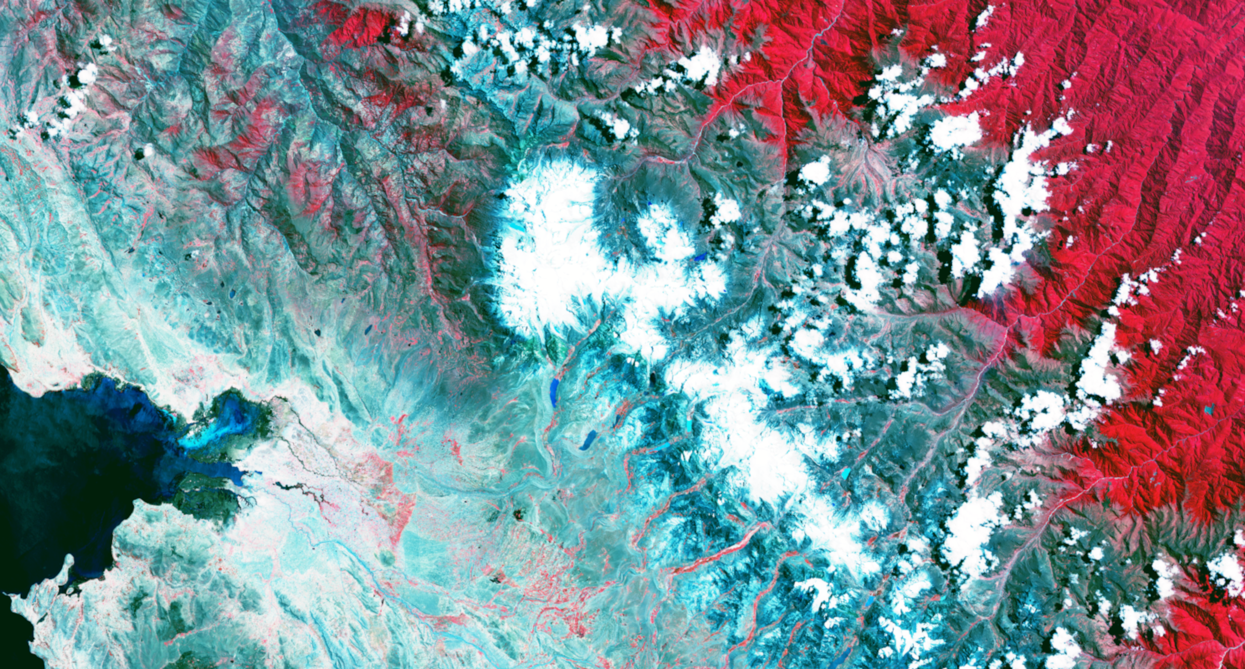
Remote sensing (analysis of satellite and aerial images)
Analysis of multispectral, hyperspectral, thermal and radar (RGB, NIR Near Infrared, IR Infrared, TIR) satellite or aerial images. Remote study of land changes. Assimilation of remote and multi-source data. Modelling of bio- and geo-physical parameters collected remotely.
Spoiler title
Hidden content
team
Prof. Marco Gianinetto
Scientific coordinator
Documentation
Regulation
Tariff schedule
CONTACT DETAILS
Marco Gianinetto E-mail: marco.gianinetto@polimi.it, Ph. +39 02 2399 6204
Via Ponzio 31, 20133 Milano Campus Bonardi, Building 15 “G.Muzio”, basement floor