SERVICES
Architectural, topographical and remote sensing surveys
Brings together experience and expertise relating to remote sensing (both satellite and aerial), photogrammetry (digital, aerial and terrestrial), numerical and thematic mapping and land monitoring through the use of topographical technologies.
The intended market for these services comprises parties in the world of research and manufacturing in addition to public and/or private stakeholders.
Interferometry/radar intensity
Capture of radar images, pre- and post- processing, interferometry and calculations.
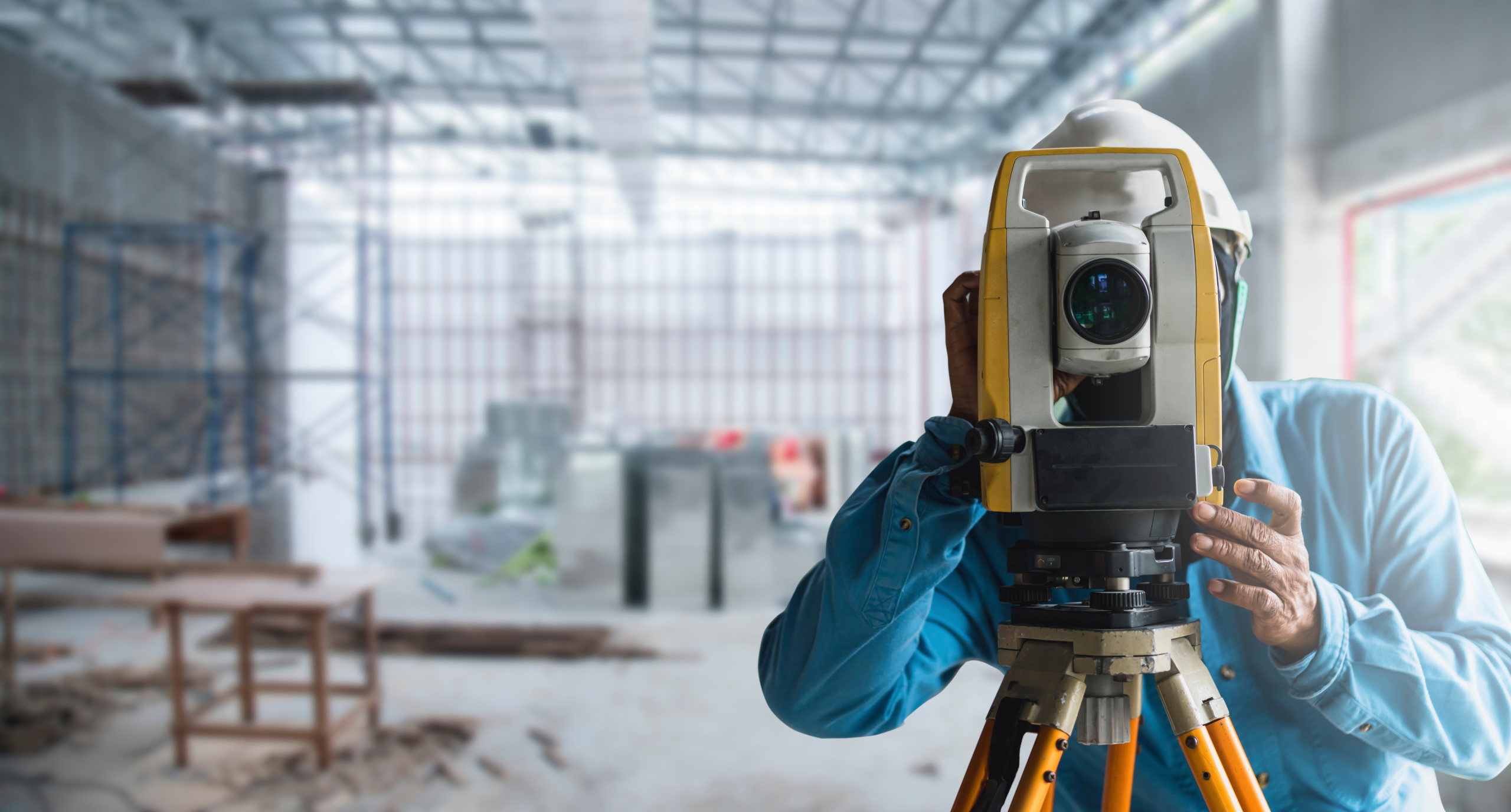
Topographical and image monitoring of land
Topographical/celerimetric/GPS surveys carried out to: monitor the land and ground deformations; monitor large civil structures and cultural assets; to monitor the natural environment, man-made environment and natural resources. Panoramic images of waterfronts, image capture from PhotoGPS with the use of calibrated cameras (full format or others) and 3D texturing of panoramic images on topographical databases integrated with laser scanners in order to generate a range of images of the fronts in support of the risk maps, VIA and maps of intervisibility. Development of Geopanapp (applications for I-devices) to support projects based on volunteered information and living lab communities.
Remote sensing (analysis of satellite and aerial images)
Analysis of multispectral, hyperspectral, thermal and radar (RGB, NIR Near Infrared, IR Infrared, TIR) satellite or aerial images. Remote study of land changes. Assimilation of remote and multi-source data. Modelling of bio- and geo-physical parameters collected remotely.
Photogrammetry and aerial photogrammetry
Aerial photogrammetry surveys using UAV technology. ground surveys of the land and the built environment and image processing.
Scanner technology
Three-dimensional surveys through the use of LiDAR sensors, terrestrial laser scanners and structured-light 3D scanners of complex architecture, sites, archaeological digs, the environment and small-scale objects. Use of data obtained for the simulation of scenarios and environmental monitoring.
Development of sensors for UAV (Unmanned Aerial Vehicle) technology
Multi-sensor acquisition systems with UAV (Unmanned Aerial Vehicle) and data processing technology. Development of integrated sensors and software modules for UAVs and ground-based multispectral acquisition systems. Calibration and orientation of integrated sensors, GPS/INS, multispectral and thermal cameras, and the development and implementation of algorithms.
Spoiler title
Hidden content